Georgian
Between the last of the medieval farmers and the arrival of the Baily family in 1820, Hall Place passed through three generations of owners whose names are easily listed but whose works are harder to see. Yet the Georgian century remade the estate more thoroughly than any period before it: a new house was built in 1780, the park took the shape it still keeps, and the first accurate maps captured a landscape whose bones — the drives, the avenues, the moat, the ponds, the great trees — are still traceable on the ground today.
The century opened with a change to the road rather than the house. The highway through Leigh was turnpiked in 1765, and it is possible that the realignment of the park’s southern boundary — pushed out from the church to give the house privacy — came about with that turnpiking. Roads and parks are quarrelsome neighbours; at Hall Place the road won its modern line, and the park retreated behind the wall that now runs along the High Street.
The first clear picture of the estate is the county map by Andrews, Dury and Herbert, surveyed in 1767 and published in 1769. It shows the site before the Burgess changes, and it is full of interest. There was an East Park drive, and an approach from the south by way of an avenue. A second avenue to the east, which does not appear on any later plan, led to an enclosure on the east side of the house. The map also shows a large enclosure to the east containing a long, narrow structure with two gardens beyond, and an L-shaped structure which may have been the house itself. Most intriguingly, no sections of moat are to be seen — in contrast to the maps of 1798 and 1801, which show the open moat roughly in its present condition. One possibility worth entertaining is that the moat was re-opened, in the rebuilding years, to resolve drainage problems. The map also shows a much larger enclosure stretching from near Price’s Wood to the church, which may be a stylised version of the park boundary, and a track running north from the park entrance to Filend Farm near Philpots — possibly the predecessor of the path along the northeastern edge of the present site, passing through Home Covert.
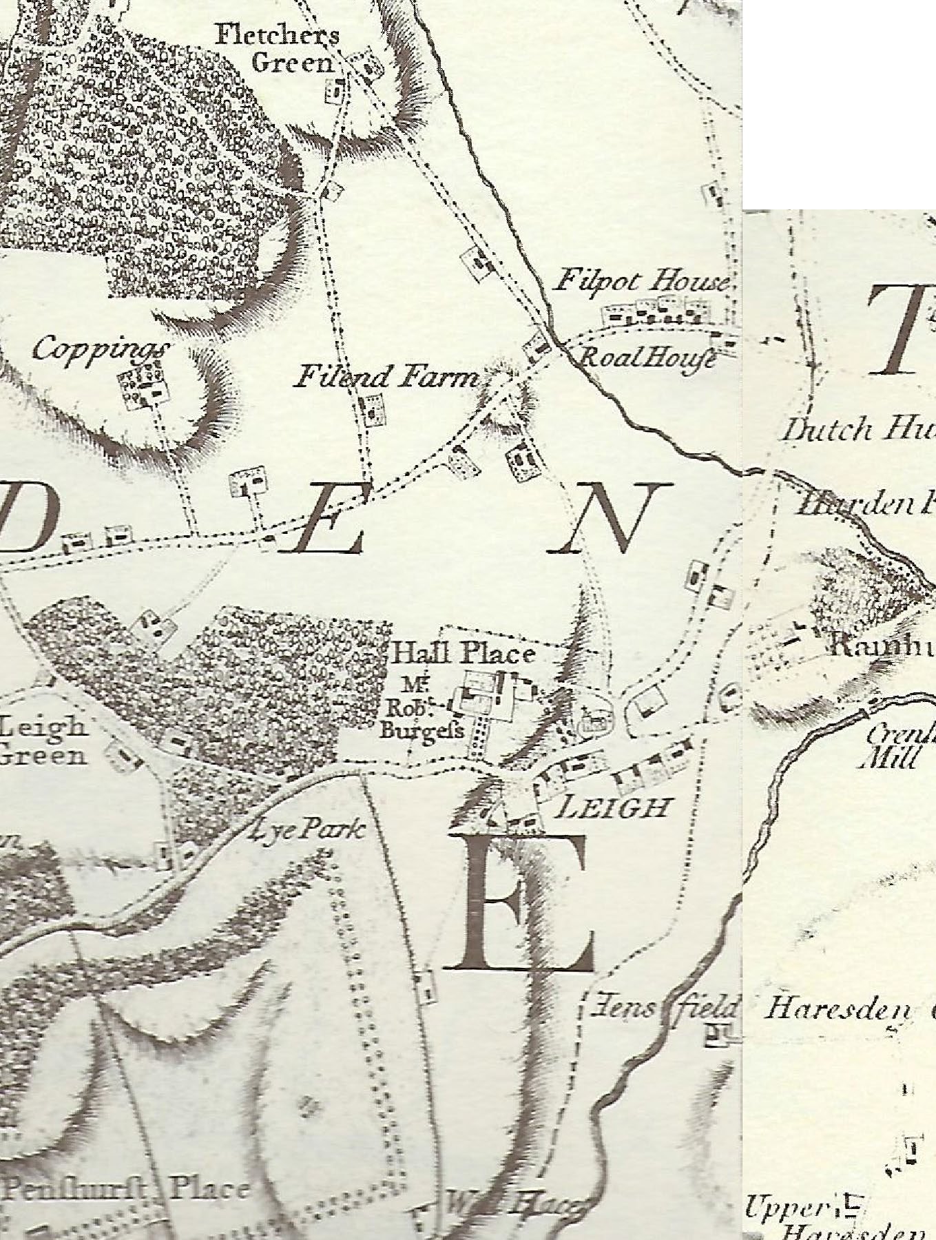
The house that the 1767 map may or may not show was soon to be replaced. The Burgess family had come to Hall Place through marriage: on William Heath’s death the property passed to Isaac Burgess in the right of his wife, and was given to their son Robert in 1753. The Burgesses were a wealthy family, and Robert Burgess was a collector of properties on the scale of the old county magnates — he bought the Chafford estate in 1783 and Groombridge Place in 1792. The house that the county histories say he rebuilt at Hall Place is dated 1780, and the drawing of that house shows it was more substantial than is generally stated. Its east elevation was carefully drawn; the west side was set within a large parterre enclosed by an elaborate metal fence; and the surroundings appear as mature parkland.
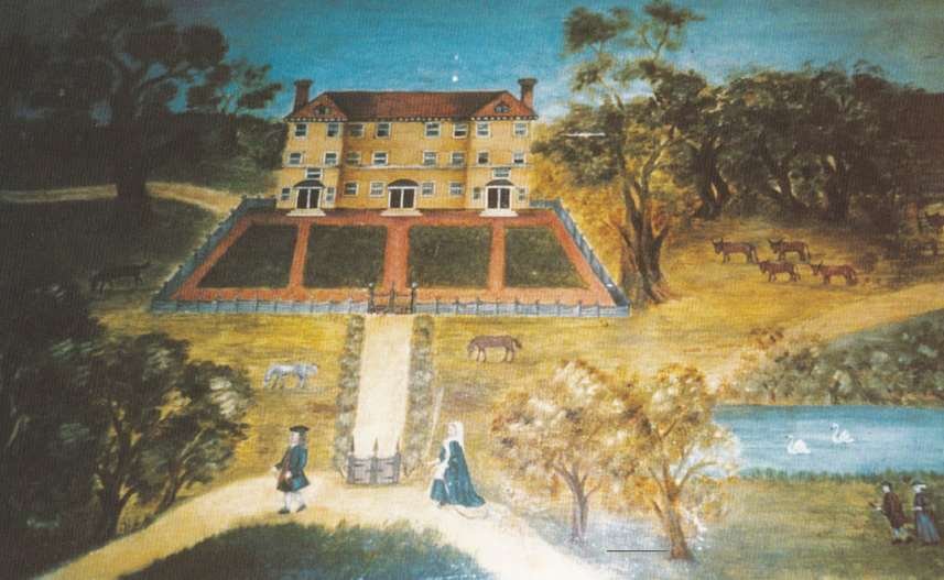
This was a proper Georgian seat, not a farmhouse wearing a gentry coat.
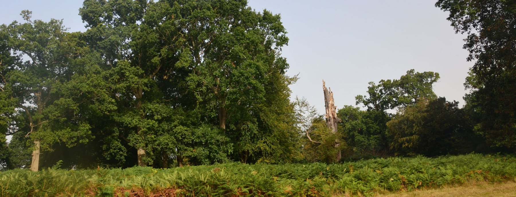
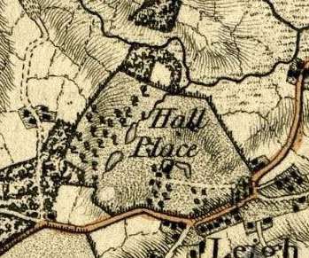
The park around it, as shown on the drawings of 1798 and by Mudge in 1801, had its boundaries marked by pales, and those boundaries are the same as today’s except in the southwestern corner, which was excluded. Two ponds lay along the bottom of the valley, where the reservoir now lies; there was open land to the east and woodland to the west on The Rookery. It is likely that some of the very fine large trees in that area were already present — trees which, on the evidence of the veteran chestnuts and oaks elsewhere in the park that mark old routes and boundaries, belong to a landscape far older than any map of it. The oldest elements of the present landscape — the park boundaries, which date back to at least the early eighteenth century, and the lakeside and Rookery trees, some perhaps of the eighteenth century — are precisely the Georgian inheritance.
A sundial dated 1805 stands on the lawn in front of the house, a small dated fossil of the terraced garden of Burgess’s day.
Robert Burgess died in 1794, and after him the estate was kept by his widow Sarah, who continued to live at Hall Place and married as her second husband James Harbroe. Sarah was an acquirer in her own right, adding to the estate with the purchase of Lower Street Farm and other land. When James Harbroe died in 1820, she sold the estate to Thomas Baily, and the Georgian era closed as the Baily one opened.
There is a curiosity in the record worth pausing on. Between Abraham Burgess’s will of 1717, which described Hall Place simply as a farm of 240 acres with its barns, and the county map of 1767, which shows a house with drives, avenues and gardens, the estate was transformed from working land into an ornamental possession — yet almost nothing is recorded of how. The rebuilding of 1780 was the visible climax, but the park may be older than the house that stands within it: the deer park boundaries here date back to at least the early eighteenth century, and the park itself is a small one whose origins reach back to at least the sixteenth. The Georgians, in other words, did not so much create a park as refurnish one — and the fact that nearly every boundary line on the 1798 drawings matches today’s shows how conservative their refurnishing was.
What did the Georgians leave the park? Three things above all. First, the house — for although the 1780 building was demolished when the present mansion rose in the early 1870s, it stood for ninety years at the heart of the estate, and its site remains an identified archaeological site within the park. The new mansion was built sixty metres away, and the old house’s gardens, terraces and sundial were absorbed into the Victorian scheme. Second, the framework: the East Park drive and the avenue approach of the 1767 map, refined after the rebuilding into the approaches shown in 1798 and 1801, established the circulation of the park that the Baily improvements would sharpen and Samuel Morley would complete. The boundary pales of 1798 are today’s boundary walls and fences, almost line for line. Third, the trees: the mature parkland setting that the 1790 drawing shows was already old in 1790, and the finest of the Rookery and lakeside trees may have been standing before the 1780 house was built.
There is one final Georgian puzzle. The 1767 map shows the house and its buildings east of the present mansion site, with gardens, an avenue and ponds; the later maps show the moat, the pale boundaries and the approaches in positions we recognise. Between those two pictures lies the transition from a working moated farm, as Abraham Burgess’s will had described it in 1717, to the ornamental estate that Thomas Baily bought in 1820. The Georgians are the half-remembered generation of Hall Place — their house is gone, their parterre fence is gone, their ponds are a reservoir — but the shape of the land they made is the shape the visitor walks today.
This page draws on the estate’s Conservation Management Plan (2023) and the National Heritage List entries for Hall Place and its registered park.