Victorian
For fifty years, from 1820 to 1870, Hall Place belonged to one family with one shared name and one clear idea of what a country estate should be. The Baily era is the hinge of the estate’s history: the house grew, the lodges and walls went up, the farms were bought, and the framework of drives, walks and gardens that every later owner worked within was laid down almost complete. When the estate map of 1871 was finished, after the sale, it recorded a landscape so nearly modern that a visitor from the 1870s would find little to puzzle over today.
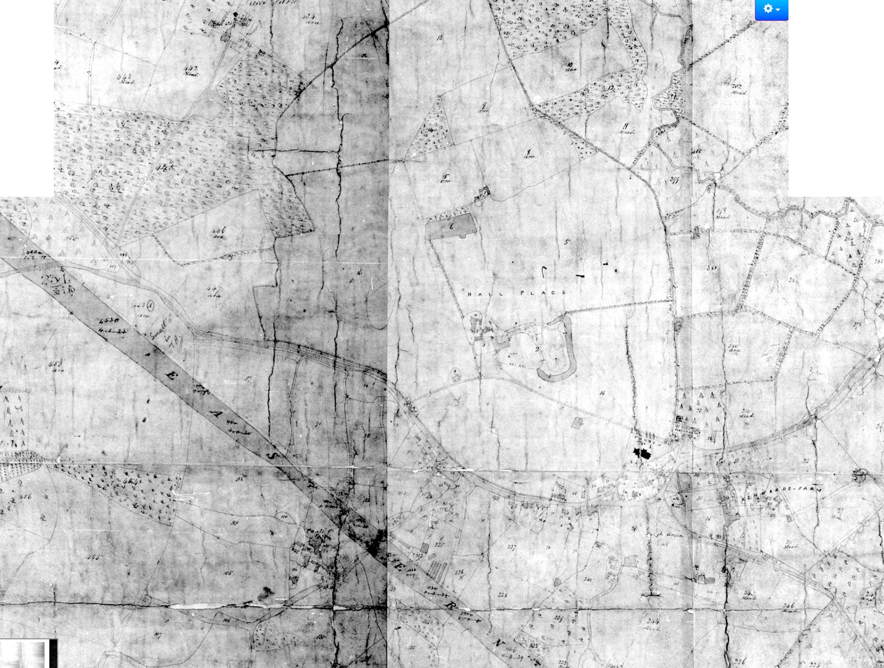
The purchase was a family affair from the start. In 1820 Thomas Baily bought Hall Place for his son, Thomas Farmer Baily — who died young, in 1828, leaving an infant son bearing the same name. The widowed Mrs Baily married William Smith, and the couple lived at Hall Place through the long minority. Nothing happened quickly: the young Thomas Farmer Baily did not come of age and begin making changes until 1845. The tithe map of 1841 therefore shows the landscape he inherited — and it is recognisably the estate of today. The park pale in the southeast ran where it runs now; in the northeast it lay further into the present park, with a distinct kink; the northwest corner was in today’s position, with the pale running south along the eastern edge of Price’s Wood. Within these boundaries virtually all the land was labelled ‘part of the park’, apart from a small triangle of gorse and the adjacent ‘upper four acres’. At the centre, the area within the old moat had become pleasure grounds, and the ha-ha was already in place. A garden lay southwest of the house and four buildings stood to the north, while the drive from north of the church — sweeping past the moat and buildings — may well have been the old alignment of the public road, with lodges at its entrances and a third close to the High Street entrance.
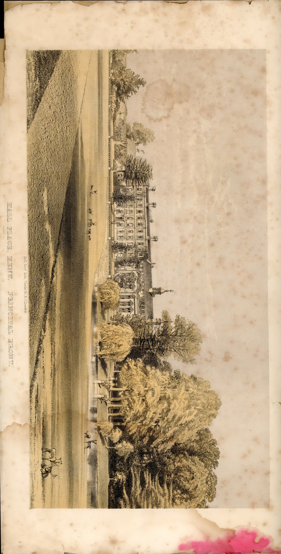
The young squire’s changes began with hospitality. He added a ‘Gothic Hall’ to the 1780 house: seventy feet long, with projecting bay windows at the east end giving space for a generous top table — a room built for entertainment on a scale the old house had never offered. He then nearly doubled the size of the house with the gothic extension of 1846, and turned to the park.
At the east end, beside the church, he replaced the old lodge which stood at the north side of the entrance with a new one on the south side of the drive, together with the ornate gothic gateway that stands there today: East Lodge and gateway, built in 1852, a lively high Victorian composition in the Tudor revival style with an interesting geometry to its plan. On the southern side he built the present Old Lodge at what was then the west end of the drive, with a similar gothic gateway just to the north of it, also in 1852. Between them, the two lodges staked the family’s claim at both ends of the village frontage, in the fashionable picturesque-gothic costume of the day.
The estate grew as the house did. Baily bought what is now Home Farm and Lucy’s Farm to the north, so that the estate ran as a long strip along the west side of the road from Leigh to Noble Tree Cross, north of Stocks Green. That road became a summer drive from Hall Place to a lodge Baily built at Stocks Green — a carriage route through his own woods and fields, with a water pipe laid along the same line. He never owned the southwestern corner of the registered park; Penshurst Lodge and the West Drive to it belong to the next owner’s time. But Baily rebuilt the front of Home Farm, built Laundry Cottage, several of the properties in the village, and the Kennels in High Wood. The park walls that run so prominently along the village frontage date from these improvements — a classic statement of ownership and status, and still one of the strongest links between the estate and the village.
Who designed it all? Thomas Baily’s architect was his cousin, Charles Baily — a man of small practice, who worked on few country houses but had, like George Devey who would later work here, a particular interest in vernacular buildings. From 1864 Thomas also employed George Devey himself, and it is not clear who was responsible for structures like the Walled Garden, which had been completed by 1870 — though a walled kitchen garden had existed on the site before 1841, so the scheme may have grown as much as it was built. Baily also laid out rides and drives through the woodland, and the sheer number of them is perhaps the most striking thing about the 1871 estate map: this was a park made for driving, walking and looking.
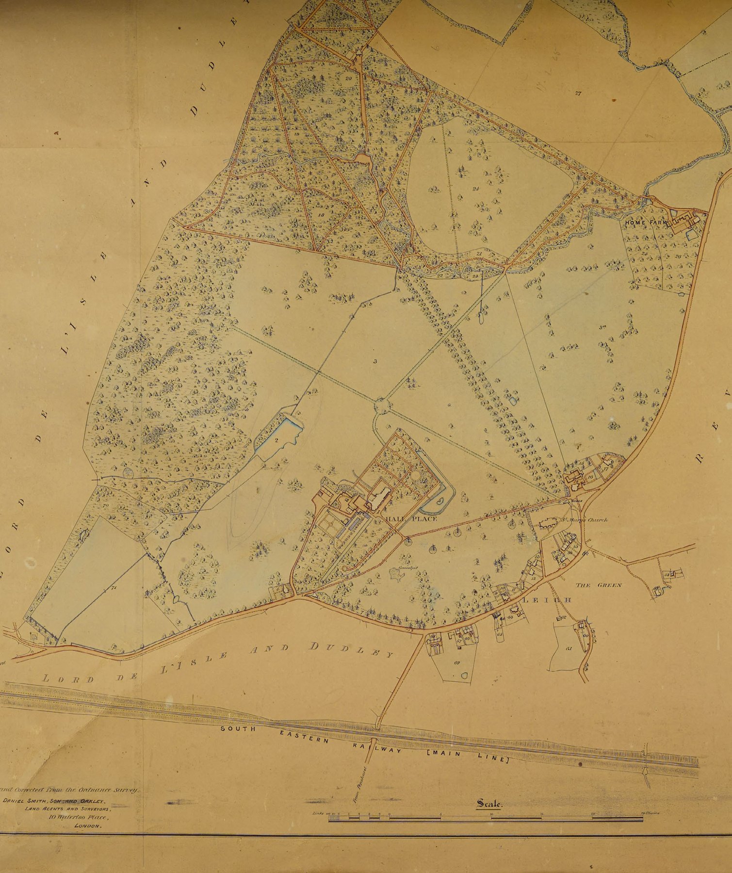
The estate was put up for sale in 1870, and its particulars — and the map completed after the purchase — describe what fifty Baily years had produced. The house, 60m southeast of the present mansion, stood with the walled garden, conservatory and glasshouses on exactly the footprint they occupy today, with stables and other service buildings to the north. Northeast of the house lay a substantial wilderness on the site of the Rose Garden and Wild Garden, with a circular area — perhaps the croquet lawn mentioned in the particulars. The Long Walk was present, as was the raised walkway with its views southeast across the park to the village. At the southern end of the gardens, where the kitchen garden now lies, stood a substantial orchard. Old Lodge and East Lodge were in place, and the particulars mention a third lodge whose location is not now clear. The south boundary wall had probably been built, for it is in the same diaper brickwork as the Walled Garden, and it was backed by conifer plantations, some of whose trees survive. The northeastern boundary of the park was marked by an avenue of deciduous trees, whose line continued to Home Covert as a path. A small lake lay at the bottom of the central valley — the present lake is Morley’s work — and to its west the land was shown as mainly woodland. The great trees of The Rookery would certainly have been standing, and may well predate the Bailys altogether.
The sales particulars read like a connoisseur’s inventory. They promoted the walks and drives in detail — those within the woodland and pleasure grounds to the north, and the routes crossing and leading out of East Park — but they made none of the usual mentions of sporting interest: Hall Place was sold as a landscape, not a shoot. The vegetation they described was of the same ambition: ‘numerous ancient oaks and pines’, ‘the rarest shrubs in great variety’, ‘groves of noble trees’. Whether Thomas Farmer Baily lived here year-round is uncertain — Hall Place was only one of the family’s properties, and the emphasis on drives may indicate mainly summer use. But summer use, at a country estate in the 1850s and 1860s, meant the full apparatus of Victorian country-house life: gardens under glass, wilderness walks, a croquet lawn, lodges manned at every gate.
In 1868 Thomas let Hall Place and retired to the Isle of Wight; in 1870 he sold the estate. The buyer, Samuel Morley, acquired a landscape already complete in its bones — house, gardens, walled kitchen garden, lodges, walls, walks, drives and a mature treescape — and everything he added to it, most famously the lake, was built upon that foundation. The Baily era is therefore not merely a chapter before the grand Victorian one: it is the frame in which the grand Victorian picture still hangs.
This page draws on the estate’s Conservation Management Plan (2023) and the National Heritage List entries for Hall Place and its registered park.